Natural Atlas
Plan & Record Outdoor Adventures with the Best Topographic Map of the USA

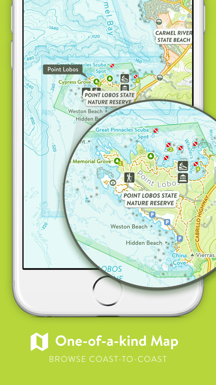
The Map
Before Natural Atlas it was very difficult to find a quality, up-to-date map that did justice to all of the great recreational and natural features in the USA. Maps are so important because they help paint a picture of what an area is like that pictures and text cannot.
A map provides two main things:
- A way to discover what is in an area at-a-glance (waterfalls, campgrounds, peaks, glaciers, trails, etc...)
- Enough detail to be able to make it easy to get where you want to go (no need to decipher convoluted text descriptions of how to get somewhere)
To accomplish this, we aggregate map data from many government agencies and land managers and spend a lot of time normalizing it, improving it, and filling in the gaps. Where there isn't any data available, we add it.
We are still working on filling out the Midwest and more of the East Coast, but we are now at a point of being able to confidently say it's the most comprehensive topo map of the Western USA anywhere.
Here are some great areas of the map to check out:
- Yellowstone Map (includes trails, geysers, thermal areas, caldera, lake bathymetry, ...)
- Big Sur Map (includes trails, campsites, coastal bathymetry, ...)
- Mount Rainier National Park Map (includes glaciers, trails, backcountry campsites, ...)
- Yosemite Map (includes viewpoints, trails, trees of the Mariposa Grove, etc...)

Everything on the Map Is Searchable
Unlike a traditional print map, everything on the Natural Atlas Topo is searchable and browsable by classification (waterfalls, campgrounds, peaks, glaciers, ...)
Everyone can contribute Knowledge
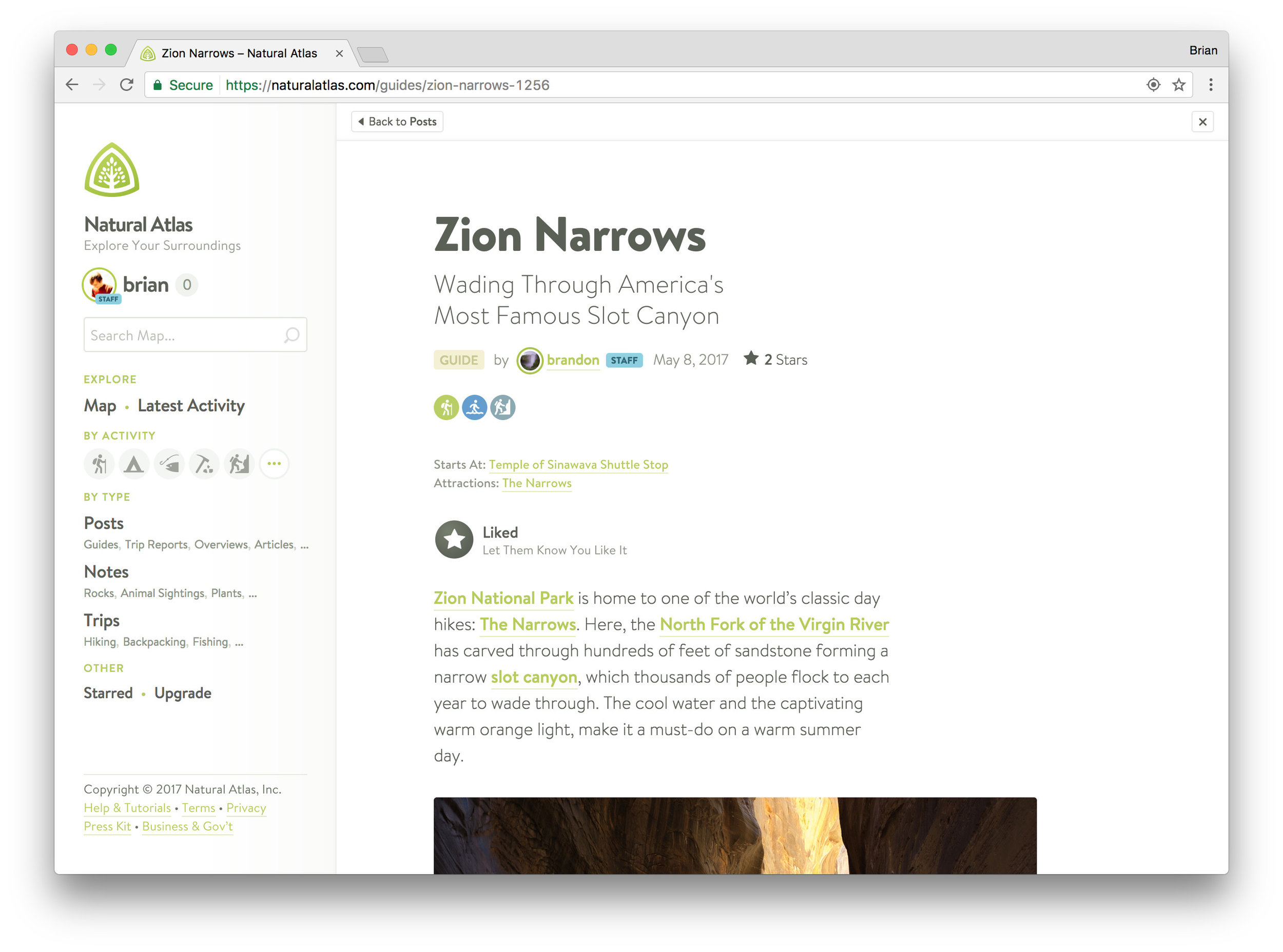
Every place on the map has page where anyone can add photos and knowledge about the place (an example place page: Grand Canyon of Yellowstone). For more opinionated single-voice writing like trip reports and guides, users can write posts (an example post: Zion Narrows Hike)
The Mobile App
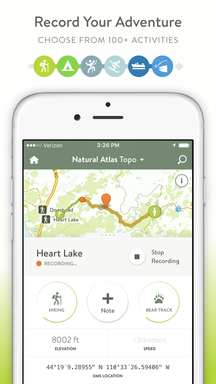
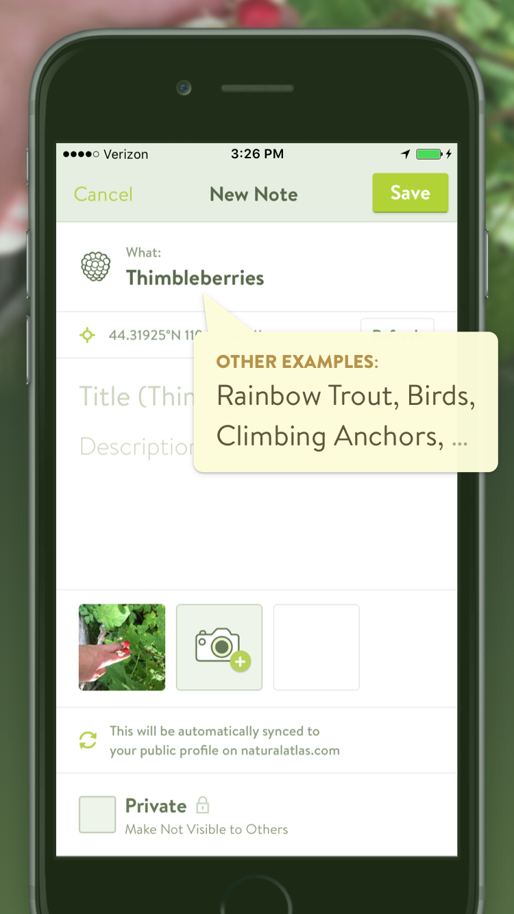
The free Natural Atlas iOS* app is the perfect app for all outdoor adventures. It gives you the best trail map in your pocket and allows you to record your journey in as much detail as you want. Take notes & geo-tagged photos along the way and classify them according the Natural Atlas taxonomy.
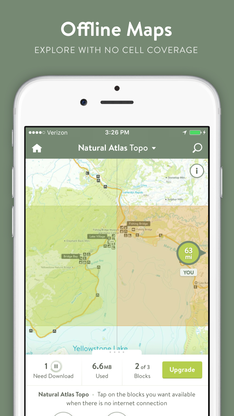
(If you want a battery-free way to take the maps outside, print maps from naturalatlas.com)
Features
– Powerful, yet simple
– Works Offline (simply tap the blocks you want available offline)
– 100+ Color-Coded Activities
– Switch Activities while Recording (e.g. Driving to Boating to Hiking)
– Stay Organized with 45,000+ Note Presets (Wildlife Species, Plants, Rocks & Minerals, and more)
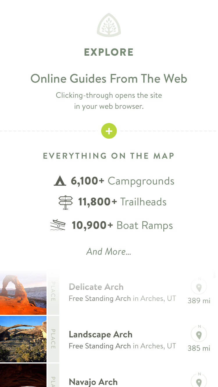
– Browse 1000’s of Campgrounds, Boat Launches, Waterfalls, Hot Springs, Arches, and more (search everything on the map)
– Advanced Search: “SF Hikes”, “Giant Sequoias in Yosemite”, “Boat Ramps on Yellowstone River”, “Oregon Beach Accesses” (internet required)
– Take Geo-Tagged Photos
– Speed, Distance, and Elevation Stats
– Star Places as “Been To”, “Want To Go To”, or “Like” – Keep a to-do list of places you want to visit
– Follow Friends and members of the community to keep tabs on their outdoor adventures
– Note Segments: highlight difficult climbing pitches, animal tracks you’re following, etc
– Explore Thousands of Guides from high-quality publishers on the web. Find the right guide, then click through to their website (opens in your web browser)
*the Natural Atlas Android app is in the works